Design and artwork for the new ZINC Projects Image Brochure, 8 pages, letter landscape
Design and artwork for the new ZINC Projects Image Brochure, 8 pages, letter landscape
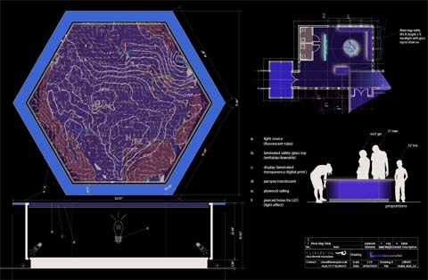
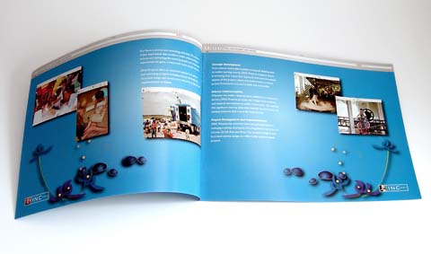
Picture: Map Table – © 2007 Claus Laemmle + ZINC Projects
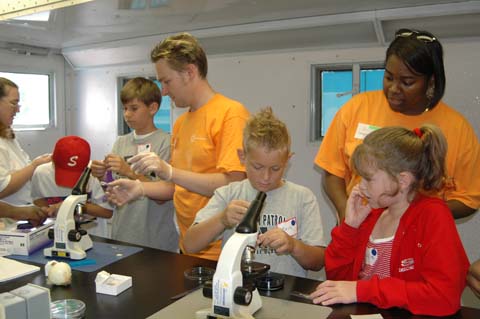
The intent is for the visitor to gain an understanding of the ecosystems in the park from the view of the worm in the ground, to the bird’s eye view in the top of the trees. The exhibits available at the EDC will be ever-changing and designed to engage visitors in the scientific process. Some of the featured activities include:
TREE TOP CANOPY WALK: You’ll have a bird’s eye view from the forest canopy as you traverse the Tree Top Canopy Walk extending from the platform at the rear of the building to a sturdy Willow Oak and continuing on to a majestic Cypress.
MAP TABLE: A back lit topographic map of the park and river system will highlight places of interest and routes to explore.
WEATHER OBSERVATIONS: Visitors can view live weather data as well as historical trends measured at different locations around the Environmental Discovery Center. Measurements include air and water temperature, soil moisture, wind speed and direction, and barometric pressure.
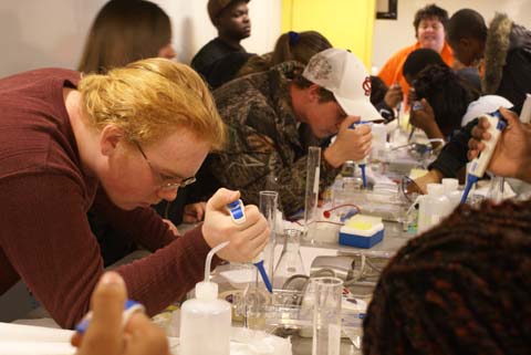
NATURE LAB TRADING AREA: Expand your collection of rocks, insects, and other natural specimens by trading with the EDC! Bring us a natural item for trade. You will be awarded points based on the item’s quality, rarity and your knowledge of it. Points can be saved or used to trade for another item.
BIRD WATCHING: Help us document sightings of various species using spotting scopes, binoculars, digital cameras, and field guides. The Raven Exhibit software from Cornell Lab of Ornithology allows visitors to explore bird vocalizations through visualization.
LYNCHES RIVER STORIES: This elegant and interactive display allows visitors to view and listen to stories of personal experiences on the river. The all-in-one computer with touch screen technology will be housed in the façade of a tobacco barn, a historically significant structure in Florence County.
GPS ACTIVITIES: Visitors will assist EDC staff in recording significant locations of park observations with handheld GPS units. GPS units may also be used for locating several geocaches on park premises.

Zusammen mit ZINC Projects entwickeln und betreiben wir mobile Lerneinheiten, speziell verzahnt mit den Lehrplänen des Bundesstaates South Carolina.Die ursprüngliche Idee, eine einfache Variante davon für die von uns für ScienceSouth entwickelten neuen Methoden des “ausserschulischen Lernens” auszuprobieren, hat sich unerwartet als äusserst erfolgreich gezeigt. Mehrere Schulen “rissen” sich förmlich um die von uns entwickelten und angebotenen Workshops.
So erfolgreich, dass wir mittlerweile diese “Mobile Learning Units” auch professionell betreiben und weitere “Trucks” auf die Reise schicken. Mittlerweile gibt es Anfragen von anderen Bundesstaaten und das Ganze hat sich zu einem eigenen Business entwickelt das inzwischen mehrere fest angestellte Mitarbeiter hat, die die Buchung und Abrechnung verwalten und mit den Trucks überall in South Carolina auf Reisen gehen. Die Trucks werden direkt von den Schulen gebucht und deren Einsatz aus Mitteln der Schulen und des Erziehungsministeriums bezahlt. Die Einsätze sind dadurch selbsttragend und erzielen sogar Gewinne, die sofort wieder in das System reinvestiert werden.